Hi, do you know how it is possible to solve this problem when uploading the track?
Thank you
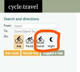
As soon as the web page is loaded, the two icons appear for not even a second and then disappear and are no longer selectable.
How can this problem be solved? I would be interested in selecting only the "gravel" routes.
Thank you
ps. the attachment is a captured image
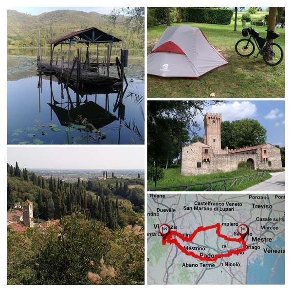
Un'idea per un cicloviaggio di 2 giorni e 180 km in un piccolo lago naturale tra le colline, attraverso le tre province Ve, Pd e Vi.
Il lago di Fimon nei colli Berci.
●Percorso effettuato e luoghi di maggior interesse storico e paesaggistico:
- ciclabile Ostiglia (Camposampiero Pd)
- Piazzola sul Brenta (villa Contarini)
- Torri di Quartesolo Vi
- Monticello (lago di Fimon Vi)

- Monte Santa Tecla e antica strada militare (Vi) sterrata con panorama e scorci sulla pianura
- Longare (Vi)
- ciclabile del "saluto" Montegaldella lungo il fiume Bacchiglione (molto bella dal punto di vista paesaggistico)
- Cervarese Santa Croce (castello medievale di San Martino della Vaneza (Pd))
- Creola vecchia (Pd)
- Padova
- Stra (Ve).
● Tipologia del percorso ad anello, circa 80% sterrato (argini e brevi single track) 20% (asfalto su strade poco trafficate).
● Note: bici Mtb front e setup di bikepacking con tenda.
I would like to congratulate the authors of this useful site
and ask if it is possible to view the different types of road surfaces
(with different colors) and the kilometers on each portion
of the route map. Thank you very much.


