
Become a supporter
Sorry to be the smart ass here, but I stumbled across a typo on the main page, under the quotes:
“Very fast routing - even over long distances” – radweise-wiki.de
Has to be: radreise-wiki.de ;)
(Rad=bike, Reise=travel)
German Text below.
The Werra has become one of my most beautiful river tours so far. Since the Werra is rather a small river and also shares the catchment area of its water with the nearby Fulda, the Werra is a river that never gets big enough for big ships to fit on it. This makes the Werra a total work of art over its nearly 300km, as it has been able to preserve its natural environment in many places.Industrially, the Werra is heavily polluted by potash mining in the Werra-Fulda potash district (wiki[de]).
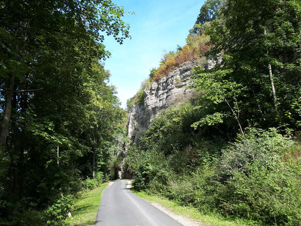
Starting in Neuhaus am Rennsteig is a bit of a challenge, whoever starts here should bring a good mountain bike or an off-road touring bike and some stamina, because it goes some kilometers over unpaved forest roads.
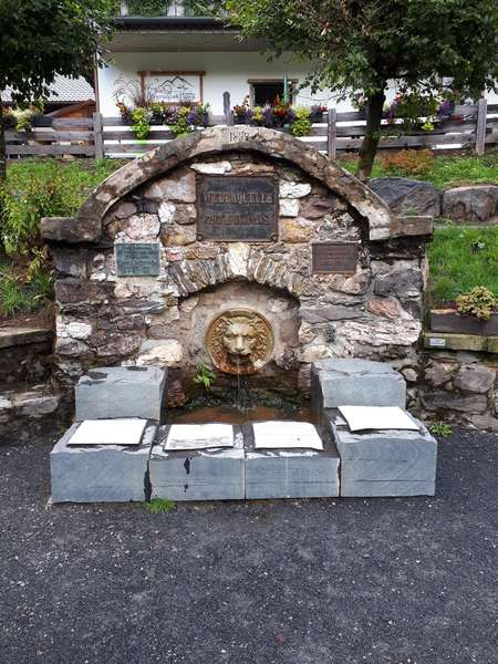
The first source of the Werra near Siegmundsburg can be visited with a small detour on the way. It lies quietly next to a country road and ripples along largely unnoticed.
The spring at Fehrenbach is interestingly not part of the official Werratalradweg (a nice German word, already Mark Twain 'appreciated' our ability to create a new word out of many single words), so I rode the "Rennsteig" for a good stretch at the beginning. The Fehrenbach spring has been expanded in recent years to include an inn and a wooden tower, and buses with day-trippers regularly drive up. After the Fehrenbach spring, the trail goes rapidly downhill again through the forest.
If you are looking for an easier entry to the Werratalradweg, you will find it in Eisfeld. It is already located in the valley and is also easily accessible by regional train.
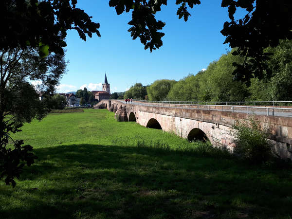
The Werra is characterized by its floodplains and the surrounding mountains, which are even higher and more rugged in Thuringia, but then become more and more hilly towards Hesse. From Eisfeld on, the Werrtalradwanderweg is very easy to ride. Apart from short climbs, you stay in the Werra plain. Also, the bike path from here on is mostly paved (asphalted). What does not have to keep you from visiting the one or other castle or fortified church along the way.
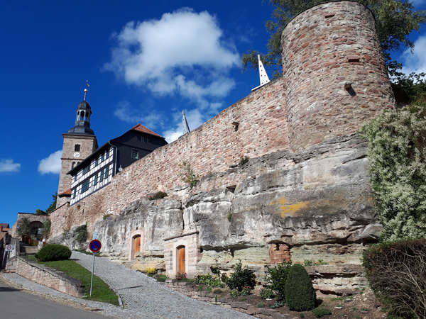
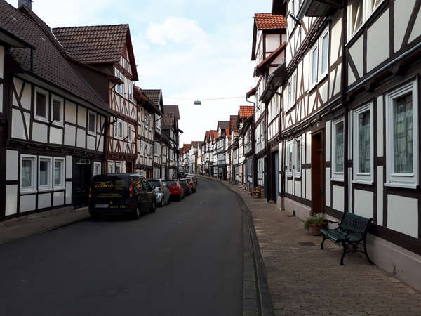
There are also some beautiful medieval towns to visit along the way, such as Meiningen, Bad Salzungen, Eschwege and Bad Sooden-Allendorf. The many half-timbered houses in the towns give the region its own charm.
Behind Vacha, the Werra was partly a border river between the FRG and the former GDR, so you 'meander' back and forth between Thuringia and Hesse in several places. So you can also find several museums about the German division. Only in Eschwege one remains in Hesse, before one comes shortly before Hann. Münden still into Lower Saxony. Unfortunately, I had to end my tour in Bad Sooden-Allendorf, but I will hopefully make up for the missing 35 km (e.g. at the upcoming Fulda tour).
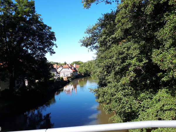
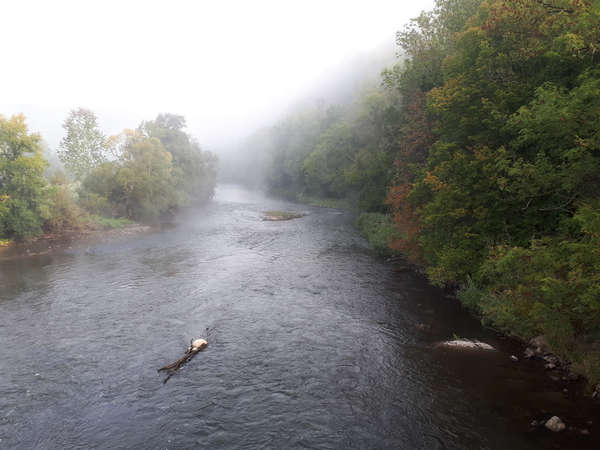
Die Werra ist eine meiner schönsten Flusstouren bisher geworden. Da die Werra eher ein kleiner Fluss ist und sich das Einzugsgebiet ihres Wassers auch noch mit der nahen Fulda teilt, ist die Werra ein Fluss, der nie groß genug wird, dass große Schiffe draufpassen. Das macht die Werra auf ihren fast 300km zu einem Gesamtkunstwerk, da sie ihre natürliche Umgebung an vielen Stellen erhalten konnte.
Industriell wird die Werra durch den Kaliabbau im Werra-Fulda-Kalirevier (wiki) stark belastet.
In Neuhaus am Rennsteig zu starten ist eine kleine Herausforderung, wer hier startet sollte ein gutes Moutainbike oder ein geländegängiges Tourenrad und etwas Kondition mitbringen, denn es geht einige Kilometer über unbefestigte Waldwege.
Die erste Quelle der Werra bei Siegmundsburg kann mit einem kleinen Abstecher auf dem Weg besucht werden. Sie liegt still neben einer Landstraße und plätschert weitestgehend unbeachtet vor sich hin.
Die Quelle bei Fehrenbach ist interessanterweise nicht Teil des offiziellen Werratalradweges (ein schönes deutsches Wort, schon Mark Twain 'schätzte' unsere Fähigkeit aus vielen einzelnen Wörtern ein neues Wort zu schaffen), so dass ich am Anfang eine gute Strecke den "Rennsteig" gefahren bin. Die Fehrenbach-Quelle wurde in den letzten Jahren um ein Gasthaus und einem Holzturm erweitert, regelmässig werden Autobusse mit Tagestouristen herangefahren. Nach der Fehrenbach-Quelle geht es dann wieder rasant bergab durch den Wald.
Wer einen einfacheren Einstieg in den Werratalradweg sucht findet diesen in Eisfeld. Es liegt bereits im Tal und ist ebenfalls mit der Regionalbahn gut erreichbar. Die Werra ist geprägt von ihren Auen und den umliegenden Bergen, die in Thüringen noch höher und schroffer sind, Richtung Hessen dann aber mehr und mehr ins hügelige gehen. Ab Eisfeld ist der Werrtalradwanderweg durchgängig sehr komfotabel zu befahren. Abgesehen von kurzen Steigungen bleibt man in der Werraebene. Auch ist der Fahrradweg ab hier meist befestigt (asphaltiert).
Was einen nicht abhalten muss, die ein oder andere Burg oder Wehrkirche am Wegesrand zu besichtigen. Auch gibt es einige wundeschöne mittelalterliche Städte am Wegesrand zu besuchen, wie z.B. Meiningen, Bad Salzungen, Eschwege und Bad Sooden-Allendorf. Die vielen Fachwerkhäuser in den Städten verleihen der Region einen eigenen Charme.
Hinter Vacha war die Werra teilweise Grenzfluss zwischen der BRD und der ehemaligen DDR, so dass man an mehreren Stellen zwischen Thüringen und Hessen hin- und her 'mäandert'. So finden sich auch mehrere Museen zur deutschen Teilung. Erst in Eschwege bleibt man in Hessen, bevor man kurz vor Hann. Münden noch nach Niedersachsen kommt. Leider musste ich meine Tour in Bad Sooden-Allendorf beenden, aber die fehlenden 35 km werde ich hoffentlich noch einmal nachholen (z.B. bei der bevorstehenden Fulda-Tour).
Hi Richard, hi @ all,
great new feature to show charging points, but on my FF and chromium, both on Linux, the charging points have no icon. If I open the icon in a new tab, I get the error message:
File not found: /site_images/charging_icon-2x.png
If I change the name to
charging_icon_2x.png
(with underline) the icon works.
On Windows I can see the Icon, there is shown a
/site_images/charging_icon_1x.png
What's the difference between the icons? Is there a typo in charging_icon_2x.png?
Best regards,
Boris (who is on bike again the whole next week)
Hi Richard,
when planning a trip, the routing summery shows the length of the route and the different types of ways. Sometimes it shows to use a ferry. I like ferries, but when planning a longer trip I'll like to know which ferry, to inform me, how often it goes. Sometimes they have seasons, or are broken for the moment. On a trip about some hundret miles (or kilometers, what ever you like ;) ) it's hard to find the 600m which the ferry takes. Is it possible to make the symbols aktive? When clicking the ferry symbol the part of the route with the ferry becomes highlited? It would also be helpful if sb likes to prevent unpaved roads or something else.
Thanks, Boris
I have some routes in single tracks. The first route ends where the second one begins. Can I put them together into one long route? I would put them together on the computer, but then they are too long for the upload.
Thanks, Boris


Made in the Cotswolds. Published by Éditions Système D Ltd.
Log in with your cycle.travel account:
| Password |
Or simply use your account on:
