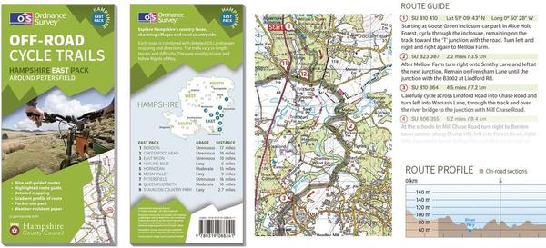
Hot on the heels of its new OS Ride app for cyclists, Ordnance Survey has announced another bike-focused product – a new series of ‘Activity Maps’.
The new paper maps show cycle routes superimposed on the familiar Landranger (1:50,000) mapping used by cyclists for many years. But rather than being supplied as one fold-out sheet, they comprise a pack of up to nine ‘pocket-sized maps’, one for each route. Each card includes turn-by-turn directions, crossreferenced to annotations on the map.
The first maps in the series show off-road cycle routes for Hampshire, split into four packs for different areas of the county. Eventually, OS hopes to expand the series to cover the whole of Britain, and to produce road cycling packs as well. It says that the sheets are aimed at “those less confident with their map reading skills”.
Each pack costs £12.99 from the OS online Map Shop, and you can sample them as a £1.99 PDF download.


