Background: The first leg of our LEJOG ride (which we completed when Covid restrictions, favourable weather and a house move allowed) ended in South Wales, just outside Cardiff. The second leg started at the same point a year later and picked up the Taff Trail just outside Pontypridd. I used my tried and trusted method of using Cycle Travel to plot a route from start to finish, with a few via points to mark overnight stops. This followed the recognised Lon Las Cymru route for most, but not all of the way.
Day 1: the ride becomes much more pleasant once the industrial estates of Treforest are left behind and great surfaces are encountered on the route through the valley to Merthyr Tydfil, which is for the most part traffic free. The climbing to Pontsticill starts after Merthyr, though it is quite gentle at first. After the reservoir there’s a descent all the way to the Usk valley. Cycle Travel took us down the paved road and in hindsight this was not the best option for us, as a fully loaded tandem requires serious braking, and we had to stop just after the steepest section to allow the wheel rims to cool down. I don’t think we were that far from a blowout! Interestingly, if this route is plotted in reverse, the ascent takes you up along the eastern side of Talybont Reservoir, which would have been a better option for our descent. We then had some ups and downs until we got to our campsite at Glasbury. We were well fed at the Harp Inn and needed the sustenance after Strava informed me that we climbed 1039m.
Day 2: the weather was still kind to us as we set off for Llanidloes, first making our way to the market town of Builth Wells on the backroads from Glasbury. We encountered the most challenging surface, an uneven forest track, on a section between Newbridge on Wye and Llanwrthwl, and if I did this ride again I’d probably risk the taking the A470 to avoid this. We’d just finished this section and passed two cyclists with skinny tyred road bikes about to head up to this track. We camped at Dol Llys farm and had a great nights sleep after what turned out to be the greatest elevation gain for the entire LEJOG ride (1212m over 80km, according to Strava).
Day 3: the climbing started almost immediately as we had to grind our way past Llyn Clywedog (we were lucky enough to see the ospreys, who have been raising chicks there for a number of years) up to the top of the Plynlimon range. The cross wind was very strong at this point and horizontal hail on your cheeks was not pleasant. After descending to Machynlleth we wimped out of the official route, which would have included a significant climb, and stuck to the A493 all the way to our campsite in Fairbourne.
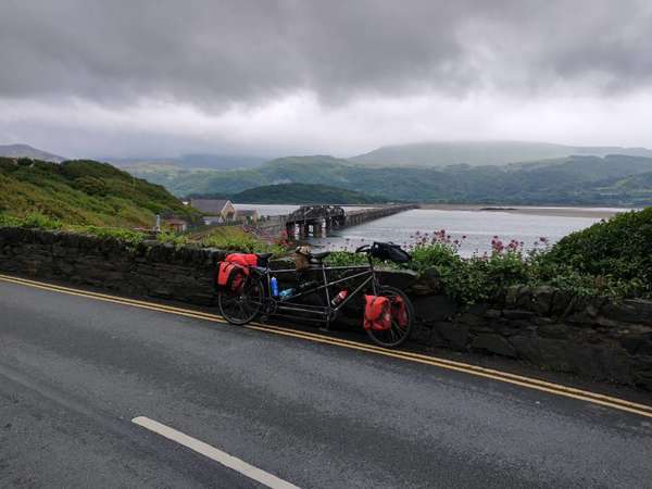
Day 4: the forecast for rain proved to be accurate though we did manage to pack a dry tent which is always a bonus on trips like this. We joined the A496 just after Barmouth and followed this, with a few short detours onto quieter sections, to just south of Harlech and then wound our way down to Porthmadoc, after which we were directed onto the wonderful Lon Eifion cycle path all the way to Caernarfon. Our initial plan was to camp near Caernarfon but given the damp conditions we decided to have an extended day which would enable us to reach home just beyond Conwy. This took us along the Menai Straits on NCN8 to the outskirts of Bangor then onto NCN5 along the North Wales coast to home. This was a great option for the second stage of our LEJOG trip and it was now time to plan stage 3!